
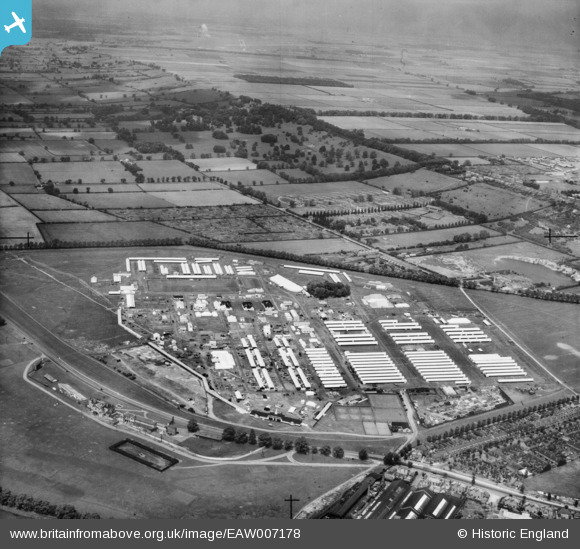
EAW007178 ENGLAND (1947). The Royal Agricultural Show Ground at West Common, Lincoln, 1947
© Copyright OpenStreetMap contributors and licensed by the OpenStreetMap Foundation. 2026. Cartography is licensed as CC BY-SA.
Nearby Images (4)
EAW007178

EAW007175

EAW007184

EAW015715

Details
| Title | [EAW007178] The Royal Agricultural Show Ground at West Common, Lincoln, 1947 |
| Reference | EAW007178 |
| Date | 25-June-1947 |
| Link | |
| Place name | LINCOLN |
| Parish | |
| District | |
| Country | ENGLAND |
| Easting / Northing | 496123, 372582 |
| Longitude / Latitude | -0.55946397600352, 53.241269823891 |
| National Grid Reference | SK961726 |
Pins

redmist |
Thursday 17th of March 2022 10:11:48 PM | |
|
redmist |
Thursday 10th of March 2022 05:01:46 PM | |
|
Bristol MW |
Wednesday 23rd of October 2019 06:13:13 AM |