
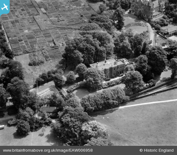
EAW006958 ENGLAND (1947). The house of Sir John Archer, Richmond Hill, 1947
© Copyright OpenStreetMap contributors and licensed by the OpenStreetMap Foundation. 2026. Cartography is licensed as CC BY-SA.
Nearby Images (15)
EAW006958

EAW006959

EAW006957

EAW006960

EAW006961

EAW006956

EAW006953

EAW006955

EAW006951

EAW006954

EAW006952

EAW008243

EPW001697

EPW001698

EPW001699

Details
| Title | [EAW006958] The house of Sir John Archer, Richmond Hill, 1947 |
| Reference | EAW006958 |
| Date | 16-June-1947 |
| Link | |
| Place name | RICHMOND HILL |
| Parish | |
| District | |
| Country | ENGLAND |
| Easting / Northing | 518141, 173878 |
| Longitude / Latitude | -0.29959433267438, 51.45105600311 |
| National Grid Reference | TQ181739 |
Pins
Be the first to add a comment to this image!