
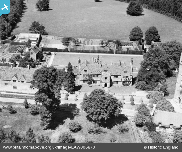
EAW006870 ENGLAND (1947). The Manor House, Purton, 1947
© Copyright OpenStreetMap contributors and licensed by the OpenStreetMap Foundation. 2026. Cartography is licensed as CC BY-SA.
Nearby Images (10)
EAW006870

EAW006866

EAW006867

EAW006863

EAW006868

EAW006864

EAW006865

EAW006869

EAW006871

EAW006862

Details
| Title | [EAW006870] The Manor House, Purton, 1947 |
| Reference | EAW006870 |
| Date | 10-June-1947 |
| Link | |
| Place name | PURTON |
| Parish | PURTON |
| District | |
| Country | ENGLAND |
| Easting / Northing | 409625, 187192 |
| Longitude / Latitude | -1.8610707561506, 51.583030325506 |
| National Grid Reference | SU096872 |
Pins
Be the first to add a comment to this image!