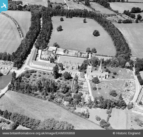
EAW006868 ENGLAND (1947). The Manor House and St Mary's Church, Purton, 1947
© Copyright OpenStreetMap contributors and licensed by the OpenStreetMap Foundation. 2026. Cartography is licensed as CC BY-SA.
Nearby Images (10)
Details
| Title | [EAW006868] The Manor House and St Mary's Church, Purton, 1947 |
| Reference | EAW006868 |
| Date | 10-June-1947 |
| Link | |
| Place name | PURTON |
| Parish | PURTON |
| District | |
| Country | ENGLAND |
| Easting / Northing | 409634, 187191 |
| Longitude / Latitude | -1.8609408761461, 51.583021179325 |
| National Grid Reference | SU096872 |
Pins
Be the first to add a comment to this image!


![[EAW006868] The Manor House and St Mary's Church, Purton, 1947](http://britainfromabove.org.uk/sites/all/libraries/aerofilms-images/public/100x100/EAW/006/EAW006868.jpg)
![[EAW006863] The Manor House and St Mary's Church, Purton, 1947. This image has been produced from a print.](http://britainfromabove.org.uk/sites/all/libraries/aerofilms-images/public/100x100/EAW/006/EAW006863.jpg)
![[EAW006870] The Manor House, Purton, 1947](http://britainfromabove.org.uk/sites/all/libraries/aerofilms-images/public/100x100/EAW/006/EAW006870.jpg)
![[EAW006866] The Manor House, Purton, 1947. This image has been produced from a print.](http://britainfromabove.org.uk/sites/all/libraries/aerofilms-images/public/100x100/EAW/006/EAW006866.jpg)
![[EAW006867] The Manor House, Purton, 1947. This image has been produced from a print.](http://britainfromabove.org.uk/sites/all/libraries/aerofilms-images/public/100x100/EAW/006/EAW006867.jpg)
![[EAW006864] The Manor House and St Mary's Church, Purton, 1947. This image has been produced from a print.](http://britainfromabove.org.uk/sites/all/libraries/aerofilms-images/public/100x100/EAW/006/EAW006864.jpg)
![[EAW006865] The Manor House, Purton, 1947. This image has been produced from a print.](http://britainfromabove.org.uk/sites/all/libraries/aerofilms-images/public/100x100/EAW/006/EAW006865.jpg)
![[EAW006871] The Manor House, Purton, from the north, 1947](http://britainfromabove.org.uk/sites/all/libraries/aerofilms-images/public/100x100/EAW/006/EAW006871.jpg)
![[EAW006869] The Manor House and tithe barn, Purton, 1947](http://britainfromabove.org.uk/sites/all/libraries/aerofilms-images/public/100x100/EAW/006/EAW006869.jpg)
![[EAW006862] The Manor House, Purton, 1947. This image has been produced from a print.](http://britainfromabove.org.uk/sites/all/libraries/aerofilms-images/public/100x100/EAW/006/EAW006862.jpg)