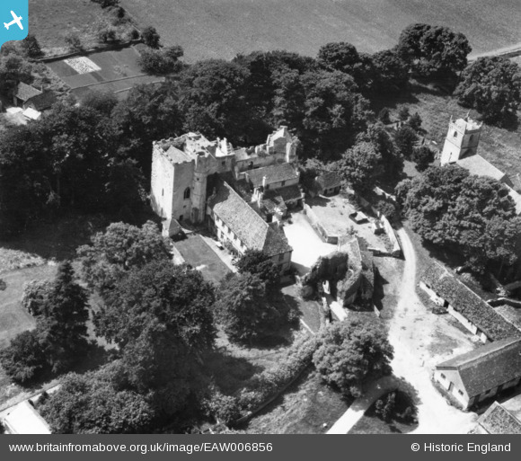
EAW006856 ENGLAND (1947). Beverston Castle, Beverston, 1947. This image has been produced from a print.
© Copyright OpenStreetMap contributors and licensed by the OpenStreetMap Foundation. 2025. Cartography is licensed as CC BY-SA.
Nearby Images (7)
Details
| Title | [EAW006856] Beverston Castle, Beverston, 1947. This image has been produced from a print. |
| Reference | EAW006856 |
| Date | 10-June-1947 |
| Link | |
| Place name | BEVERSTON |
| Parish | BEVERSTON |
| District | |
| Country | ENGLAND |
| Easting / Northing | 386172, 193951 |
| Longitude / Latitude | -2.1998626331352, 51.643721653335 |
| National Grid Reference | ST862940 |
Pins
Be the first to add a comment to this image!


![[EAW006856] Beverston Castle, Beverston, 1947. This image has been produced from a print.](http://britainfromabove.org.uk/sites/all/libraries/aerofilms-images/public/100x100/EAW/006/EAW006856.jpg)
![[EAW006854] Beverston Castle, Beverston, 1947. This image has been produced from a print.](http://britainfromabove.org.uk/sites/all/libraries/aerofilms-images/public/100x100/EAW/006/EAW006854.jpg)
![[EAW006853] Beverston Castle, Beverston, 1947](http://britainfromabove.org.uk/sites/all/libraries/aerofilms-images/public/100x100/EAW/006/EAW006853.jpg)
![[EAW006850] Beverston Castle, Beverston, 1947](http://britainfromabove.org.uk/sites/all/libraries/aerofilms-images/public/100x100/EAW/006/EAW006850.jpg)
![[EAW006852] Beverston Castle and St Mary's Church, Beverston, 1947. This image has been produced from a print.](http://britainfromabove.org.uk/sites/all/libraries/aerofilms-images/public/100x100/EAW/006/EAW006852.jpg)
![[EAW006851] Beverston Castle, Beverston, 1947](http://britainfromabove.org.uk/sites/all/libraries/aerofilms-images/public/100x100/EAW/006/EAW006851.jpg)
![[EAW006855] Beverston Castle and St Mary's Church, Beverston, 1947. This image has been produced from a print.](http://britainfromabove.org.uk/sites/all/libraries/aerofilms-images/public/100x100/EAW/006/EAW006855.jpg)