
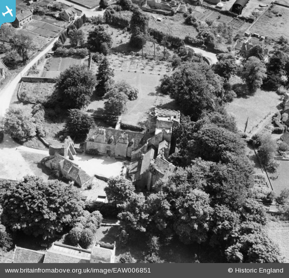
EAW006851 ENGLAND (1947). Beverston Castle, Beverston, 1947
© Copyright OpenStreetMap contributors and licensed by the OpenStreetMap Foundation. 2025. Cartography is licensed as CC BY-SA.
Nearby Images (7)
EAW006851

EAW006850

EAW006853

EAW006855

EAW006854

EAW006856

EAW006852

Details
| Title | [EAW006851] Beverston Castle, Beverston, 1947 |
| Reference | EAW006851 |
| Date | 10-June-1947 |
| Link | |
| Place name | BEVERSTON |
| Parish | BEVERSTON |
| District | |
| Country | ENGLAND |
| Easting / Northing | 386157, 193941 |
| Longitude / Latitude | -2.2000790380319, 51.64363136186 |
| National Grid Reference | ST862939 |
Pins
Be the first to add a comment to this image!