
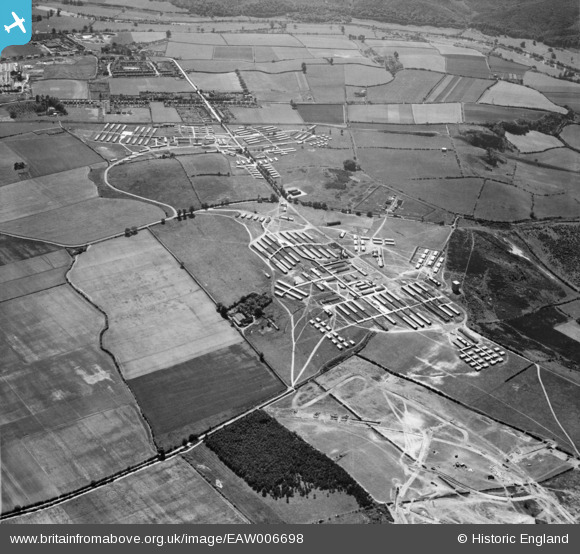
EAW006698 ENGLAND (1947). Camp Bewdley (Burlish Camp), Stourport-on-Severn, 1947
© Copyright OpenStreetMap contributors and licensed by the OpenStreetMap Foundation. 2025. Cartography is licensed as CC BY-SA.
Nearby Images (2)
EAW006698
, Stourport-on-Severn, 1947")
EAW006702
 and environs, Stourport-on-Severn, 1947")
Details
| Title | [EAW006698] Camp Bewdley (Burlish Camp), Stourport-on-Severn, 1947 |
| Reference | EAW006698 |
| Date | 28-May-1947 |
| Link | |
| Place name | STOURPORT-ON-SEVERN |
| Parish | STOURPORT-ON-SEVERN |
| District | |
| Country | ENGLAND |
| Easting / Northing | 380963, 273566 |
| Longitude / Latitude | -2.2795746014367, 52.359438253055 |
| National Grid Reference | SO810736 |
Pins

redmist |
Sunday 10th of October 2021 10:37:57 PM |
User Comment Contributions
Find out more about Burlish Camp http://burlishcamp.co.uk/ |
Lynda Tubbs |
Tuesday 10th of December 2013 09:54:56 AM |