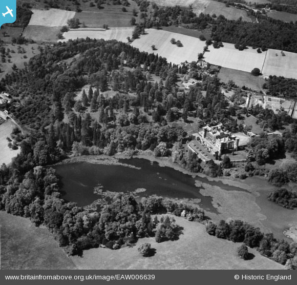
EAW006639 ENGLAND (1947). Eastnor Castle and Lake, Eastnor, 1947
© Copyright OpenStreetMap contributors and licensed by the OpenStreetMap Foundation. 2026. Cartography is licensed as CC BY-SA.
Nearby Images (9)
Details
| Title | [EAW006639] Eastnor Castle and Lake, Eastnor, 1947 |
| Reference | EAW006639 |
| Date | 30-May-1947 |
| Link | |
| Place name | EASTNOR |
| Parish | EASTNOR |
| District | |
| Country | ENGLAND |
| Easting / Northing | 373545, 236744 |
| Longitude / Latitude | -2.3856363241908, 52.028054930305 |
| National Grid Reference | SO735367 |
Pins
Be the first to add a comment to this image!


![[EAW006639] Eastnor Castle and Lake, Eastnor, 1947](http://britainfromabove.org.uk/sites/all/libraries/aerofilms-images/public/100x100/EAW/006/EAW006639.jpg)
![[EAW006634] Eastnor Castle and Lake, Eastnor, 1947. This image was marked by Aerofilms Ltd for photo editing.](http://britainfromabove.org.uk/sites/all/libraries/aerofilms-images/public/100x100/EAW/006/EAW006634.jpg)
![[EAW006635] Eastnor Castle, Eastnor, 1947](http://britainfromabove.org.uk/sites/all/libraries/aerofilms-images/public/100x100/EAW/006/EAW006635.jpg)
![[EPW005399] Eastnor Castle, Eastnor, 1921](http://britainfromabove.org.uk/sites/all/libraries/aerofilms-images/public/100x100/EPW/005/EPW005399.jpg)
![[EAW006640] Eastnor Castle, Eastnor, 1947. This image was marked by Aerofilms Ltd for photo editing.](http://britainfromabove.org.uk/sites/all/libraries/aerofilms-images/public/100x100/EAW/006/EAW006640.jpg)
![[EAW006638] Eastnor Castle, Eastnor, 1947](http://britainfromabove.org.uk/sites/all/libraries/aerofilms-images/public/100x100/EAW/006/EAW006638.jpg)
![[EPW005397] Eastnor Castle, Eastnor, 1921](http://britainfromabove.org.uk/sites/all/libraries/aerofilms-images/public/100x100/EPW/005/EPW005397.jpg)
![[EPW005398] Eastnor Castle, Eastnor, 1921](http://britainfromabove.org.uk/sites/all/libraries/aerofilms-images/public/100x100/EPW/005/EPW005398.jpg)
![[EAW006637] Eastnor Castle and Lake, Eastnor, 1947](http://britainfromabove.org.uk/sites/all/libraries/aerofilms-images/public/100x100/EAW/006/EAW006637.jpg)