
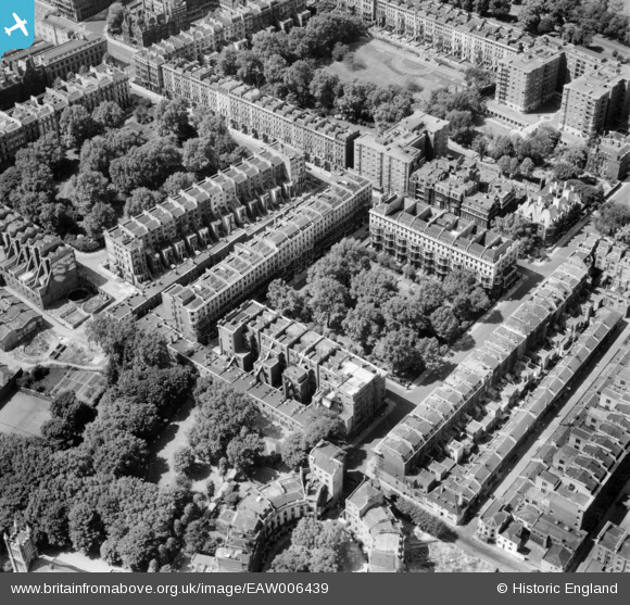
EAW006439 ENGLAND (1947). Ennismore Gardens and surrounding streets, Knightsbridge, 1947
© Copyright OpenStreetMap contributors and licensed by the OpenStreetMap Foundation. 2026. Cartography is licensed as CC BY-SA.
Nearby Images (14)
EAW006439

EAW006440

EAW006445

EAW006437

EAW006443

EAW006444

EAW006438

EAW006441

EAW006442

EAW000554

EAW000556

EPW010190

EAW015858

EPW036286

Details
| Title | [EAW006439] Ennismore Gardens and surrounding streets, Knightsbridge, 1947 |
| Reference | EAW006439 |
| Date | 2-June-1947 |
| Link | |
| Place name | KNIGHTSBRIDGE |
| Parish | |
| District | |
| Country | ENGLAND |
| Easting / Northing | 527069, 179411 |
| Longitude / Latitude | -0.16917105780519, 51.49885287484 |
| National Grid Reference | TQ271794 |
Pins
Be the first to add a comment to this image!