
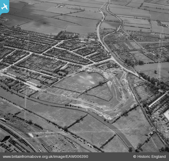
EAW006390 ENGLAND (1947). Housing on Welbeck Road under construction and the surrounding residential area, Long Eaton, 1947. This image was marked by Aerofilms Ltd for photo editing.
© Copyright OpenStreetMap contributors and licensed by the OpenStreetMap Foundation. 2026. Cartography is licensed as CC BY-SA.
Nearby Images (17)
EAW006390

EAW016178

EAW016180

EAW006391

EAW016186

EAW006387

EAW016183

EAW016182

EAW006385

EAW016181

EAW006388

EAW006384

EAW016185

EAW006389

EAW006386

EAW016179

EAW016184

Details
| Title | [EAW006390] Housing on Welbeck Road under construction and the surrounding residential area, Long Eaton, 1947. This image was marked by Aerofilms Ltd for photo editing. |
| Reference | EAW006390 |
| Date | 27-May-1947 |
| Link | |
| Place name | LONG EATON |
| Parish | |
| District | |
| Country | ENGLAND |
| Easting / Northing | 448000, 335272 |
| Longitude / Latitude | -1.2861303094857, 52.912408725692 |
| National Grid Reference | SK480353 |
Pins

Dave_Hunt |
Friday 6th of March 2020 04:46:47 PM | |
|
Dave_Hunt |
Friday 6th of March 2020 04:44:46 PM | |
|
Dave_Hunt |
Friday 6th of March 2020 04:43:32 PM | |
|
Dave_Hunt |
Friday 6th of March 2020 04:42:54 PM | |
|
redmist |
Tuesday 18th of June 2019 08:12:50 PM | |
|
redmist |
Tuesday 18th of June 2019 08:06:48 PM |