
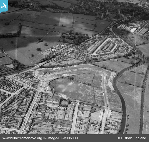
EAW006389 ENGLAND (1947). Housing on Welbeck Road under construction and housing off Margaret Avenue, Long Eaton, 1947. This image was marked by Aerofilms Ltd for photo editing.
© Copyright OpenStreetMap contributors and licensed by the OpenStreetMap Foundation. 2026. Cartography is licensed as CC BY-SA.
Nearby Images (17)
EAW006389

EAW006386

EAW006388

EAW016181

EAW016185

EAW016183

EAW006391

EAW016186

EAW016182

EAW016180

EAW006384

EAW016178

EAW006390

EAW016184

EAW006385

EAW016179

EAW006387

Details
| Title | [EAW006389] Housing on Welbeck Road under construction and housing off Margaret Avenue, Long Eaton, 1947. This image was marked by Aerofilms Ltd for photo editing. |
| Reference | EAW006389 |
| Date | 27-May-1947 |
| Link | |
| Place name | LONG EATON |
| Parish | |
| District | |
| Country | ENGLAND |
| Easting / Northing | 447977, 335457 |
| Longitude / Latitude | -1.2864450097724, 52.914073865803 |
| National Grid Reference | SK480355 |
Pins
Be the first to add a comment to this image!