
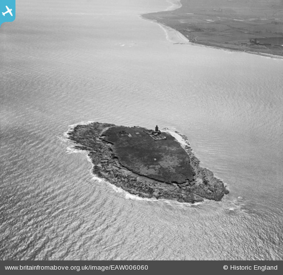
EAW006060 ENGLAND (1947). Coquet Island and the Northumberland Coast, Coquet Island, 1947
© Copyright OpenStreetMap contributors and licensed by the OpenStreetMap Foundation. 2026. Cartography is licensed as CC BY-SA.
Nearby Images (2)
EAW006060

EAW006061

Details
| Title | [EAW006060] Coquet Island and the Northumberland Coast, Coquet Island, 1947 |
| Reference | EAW006060 |
| Date | 21-May-1947 |
| Link | |
| Place name | COQUET ISLAND |
| Parish | HAUXLEY |
| District | |
| Country | ENGLAND |
| Easting / Northing | 429337, 604493 |
| Longitude / Latitude | -1.53749271768, 55.333578415513 |
| National Grid Reference | NU293045 |
Pins
Be the first to add a comment to this image!