
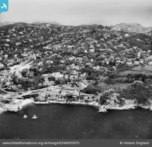
EAW005870 ENGLAND (1947). The Imperial Hotel, Park Hill and environs, Torquay, from the south-west, 1947
© Copyright OpenStreetMap contributors and licensed by the OpenStreetMap Foundation. 2026. Cartography is licensed as CC BY-SA.
Nearby Images (20)
EAW005870

EAW005866

EAW005867

EAW005872

EAW005873

EAW005869

EAW005865

EAW005874

EPR000338

EAW005868

EAW030901

EAW005871

EAW030902

EAW030899

EAW030900

EAW030898

EAW030903

EAW031976

EPW023716

EAW005875

Details
| Title | [EAW005870] The Imperial Hotel, Park Hill and environs, Torquay, from the south-west, 1947 |
| Reference | EAW005870 |
| Date | 15-May-1947 |
| Link | |
| Place name | TORQUAY |
| Parish | |
| District | |
| Country | ENGLAND |
| Easting / Northing | 292130, 62981 |
| Longitude / Latitude | -3.5197587567156, 50.456129912279 |
| National Grid Reference | SX921630 |
Pins

redmist |
Thursday 9th of July 2020 05:14:15 PM | |
|
redmist |
Thursday 9th of July 2020 05:11:38 PM |