
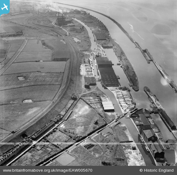
EAW005670 ENGLAND (1947). Francis Dock, Alfred Dock and the Manchester Ship Canal, Runcorn, 1947
© Copyright OpenStreetMap contributors and licensed by the OpenStreetMap Foundation. 2026. Cartography is licensed as CC BY-SA.
Nearby Images (5)
EAW005670

EAW005669

EAW005666

EAW005665

EAW005674

Details
| Title | [EAW005670] Francis Dock, Alfred Dock and the Manchester Ship Canal, Runcorn, 1947 |
| Reference | EAW005670 |
| Date | 15-May-1947 |
| Link | |
| Place name | RUNCORN |
| Parish | |
| District | |
| Country | ENGLAND |
| Easting / Northing | 350247, 382706 |
| Longitude / Latitude | -2.7472985901973, 53.338646254768 |
| National Grid Reference | SJ502827 |
Pins

Bottom Yard |
Sunday 30th of March 2025 05:04:17 PM | |
|
Bottom Yard |
Saturday 5th of October 2024 12:22:34 PM | |

Ginger79 |
Wednesday 22nd of November 2023 01:09:18 AM | |
|
Ginger79 |
Wednesday 22nd of November 2023 01:08:50 AM | |
|
Mike |
Wednesday 15th of January 2020 04:15:00 PM | |
|
redmist |
Wednesday 26th of December 2018 12:04:47 PM | |
|
redmist |
Wednesday 26th of December 2018 12:04:13 PM |