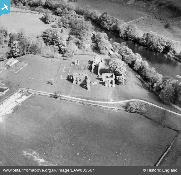
EAW005564 ENGLAND (1947). The abbey ruins, Egglestone Abbey, 1947
© Copyright OpenStreetMap contributors and licensed by the OpenStreetMap Foundation. 2025. Cartography is licensed as CC BY-SA.
Nearby Images (5)
Details
| Title | [EAW005564] The abbey ruins, Egglestone Abbey, 1947 |
| Reference | EAW005564 |
| Date | 17-May-1947 |
| Link | |
| Place name | EGGLESTONE ABBEY |
| Parish | EGGLESTONE ABBEY |
| District | |
| Country | ENGLAND |
| Easting / Northing | 406245, 515097 |
| Longitude / Latitude | -1.903486944915, 54.530984718725 |
| National Grid Reference | NZ062151 |
Pins
Be the first to add a comment to this image!


![[EAW005564] The abbey ruins, Egglestone Abbey, 1947](http://britainfromabove.org.uk/sites/all/libraries/aerofilms-images/public/100x100/EAW/005/EAW005564.jpg)
![[EAW005562] The abbey ruins, Egglestone Abbey, 1947](http://britainfromabove.org.uk/sites/all/libraries/aerofilms-images/public/100x100/EAW/005/EAW005562.jpg)
![[EAW005561] The abbey ruins, Egglestone Abbey, 1947](http://britainfromabove.org.uk/sites/all/libraries/aerofilms-images/public/100x100/EAW/005/EAW005561.jpg)
![[EAW005563] The abbey ruins, Egglestone Abbey, 1947](http://britainfromabove.org.uk/sites/all/libraries/aerofilms-images/public/100x100/EAW/005/EAW005563.jpg)
![[EAW005560] The abbey ruins, Abbey Farm and environs, Egglestone Abbey, 1947](http://britainfromabove.org.uk/sites/all/libraries/aerofilms-images/public/100x100/EAW/005/EAW005560.jpg)