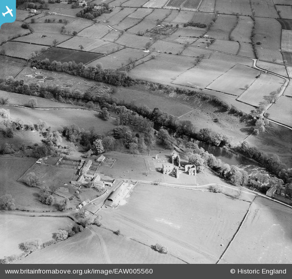
EAW005560 ENGLAND (1947). The abbey ruins, Abbey Farm and environs, Egglestone Abbey, 1947
© Copyright OpenStreetMap contributors and licensed by the OpenStreetMap Foundation. 2025. Cartography is licensed as CC BY-SA.
Nearby Images (5)
Details
| Title | [EAW005560] The abbey ruins, Abbey Farm and environs, Egglestone Abbey, 1947 |
| Reference | EAW005560 |
| Date | 17-May-1947 |
| Link | |
| Place name | EGGLESTONE ABBEY |
| Parish | STARTFORTH |
| District | |
| Country | ENGLAND |
| Easting / Northing | 406197, 515259 |
| Longitude / Latitude | -1.9042253490501, 54.532441348499 |
| National Grid Reference | NZ062153 |
Pins

Chells809 |
Thursday 26th of June 2014 09:55:05 PM |


![[EAW005560] The abbey ruins, Abbey Farm and environs, Egglestone Abbey, 1947](http://britainfromabove.org.uk/sites/all/libraries/aerofilms-images/public/100x100/EAW/005/EAW005560.jpg)
![[EAW005563] The abbey ruins, Egglestone Abbey, 1947](http://britainfromabove.org.uk/sites/all/libraries/aerofilms-images/public/100x100/EAW/005/EAW005563.jpg)
![[EAW005561] The abbey ruins, Egglestone Abbey, 1947](http://britainfromabove.org.uk/sites/all/libraries/aerofilms-images/public/100x100/EAW/005/EAW005561.jpg)
![[EAW005562] The abbey ruins, Egglestone Abbey, 1947](http://britainfromabove.org.uk/sites/all/libraries/aerofilms-images/public/100x100/EAW/005/EAW005562.jpg)
![[EAW005564] The abbey ruins, Egglestone Abbey, 1947](http://britainfromabove.org.uk/sites/all/libraries/aerofilms-images/public/100x100/EAW/005/EAW005564.jpg)