
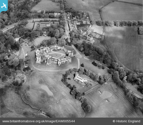
EAW005544 ENGLAND (1947). Brancepeth Castle and St Brandon's Church, Brancepeth, 1947
© Copyright OpenStreetMap contributors and licensed by the OpenStreetMap Foundation. 2026. Cartography is licensed as CC BY-SA.
Nearby Images (5)
EAW005544

EAW005547

EAW005543

EAW005545

EAW005546

Details
| Title | [EAW005544] Brancepeth Castle and St Brandon's Church, Brancepeth, 1947 |
| Reference | EAW005544 |
| Date | 17-May-1947 |
| Link | |
| Place name | BRANCEPETH |
| Parish | BRANCEPETH |
| District | |
| Country | ENGLAND |
| Easting / Northing | 422401, 537750 |
| Longitude / Latitude | -1.6520745011103, 54.73412394074 |
| National Grid Reference | NZ224378 |
Pins
Be the first to add a comment to this image!