
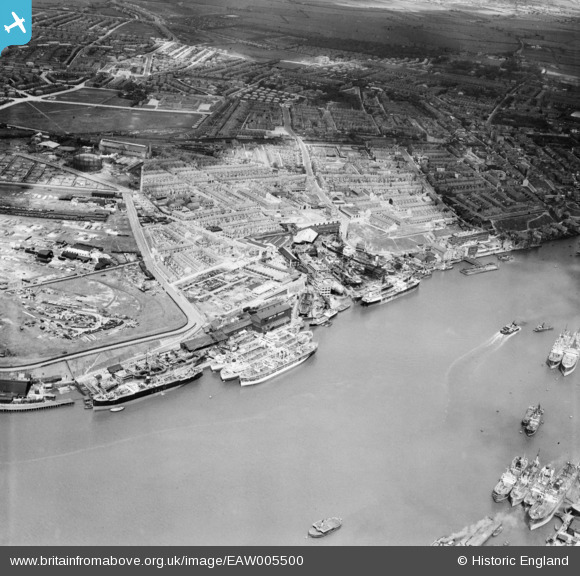
EAW005500 ENGLAND (1947). Smith's Docks, the Bull Ring Graving Docks and the town, North Shields, 1947
© Copyright OpenStreetMap contributors and licensed by the OpenStreetMap Foundation. 2026. Cartography is licensed as CC BY-SA.
Nearby Images (8)
EAW005500

EAW005499

EAW005505

EAW005501

EAW005498

EAW005502

EAW005504

EPW019844

Details
| Title | [EAW005500] Smith's Docks, the Bull Ring Graving Docks and the town, North Shields, 1947 |
| Reference | EAW005500 |
| Date | 15-May-1947 |
| Link | |
| Place name | NORTH SHIELDS |
| Parish | |
| District | |
| Country | ENGLAND |
| Easting / Northing | 435476, 567541 |
| Longitude / Latitude | -1.4453430119676, 55.001102928977 |
| National Grid Reference | NZ355675 |
Pins

redmist |
Thursday 2nd of May 2019 11:43:23 PM | |
|
cheviotwalks |
Sunday 19th of October 2014 07:32:10 PM |