
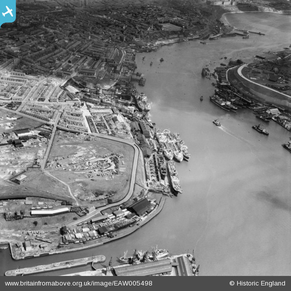
EAW005498 ENGLAND (1947). Smith's Docks and the Bull Ring Graving Docks alongside Shields Harbour, North Shields, 1947
© Copyright OpenStreetMap contributors and licensed by the OpenStreetMap Foundation. 2026. Cartography is licensed as CC BY-SA.
Nearby Images (8)
EAW005498

EAW005504

EAW005503

EAW005502

EAW005501

EAW005499

EAW005500

EPW019844

Details
| Title | [EAW005498] Smith's Docks and the Bull Ring Graving Docks alongside Shields Harbour, North Shields, 1947 |
| Reference | EAW005498 |
| Date | 15-May-1947 |
| Link | |
| Place name | NORTH SHIELDS |
| Parish | |
| District | |
| Country | ENGLAND |
| Easting / Northing | 435515, 567377 |
| Longitude / Latitude | -1.4447536443576, 54.999626313424 |
| National Grid Reference | NZ355674 |
Pins

redmist |
Thursday 23rd of November 2023 04:10:07 PM | |
|
redmist |
Friday 22nd of November 2019 07:22:19 PM | |
|
redmist |
Thursday 2nd of May 2019 11:40:46 PM | |
|
redmist |
Thursday 2nd of May 2019 11:33:24 PM |