
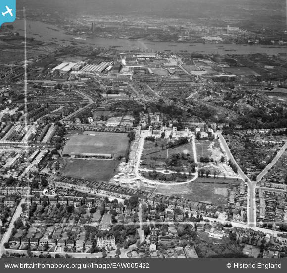
EAW005422 ENGLAND (1947). Prefabricated housing under construction around Rectory Field Crescent, Rectory Field and environs, Charlton, 1947. This image was marked by Aerofilms Ltd for photo editing.
© Copyright OpenStreetMap contributors and licensed by the OpenStreetMap Foundation. 2026. Cartography is licensed as CC BY-SA.
Nearby Images (13)
EAW005422

EAW005420

EAW005430

EAW005427

EAW005423

EAW005418

EAW005426

EAW005428

EAW005425

EAW005429

EAW005419

EAW005421

EAW042244

Details
| Title | [EAW005422] Prefabricated housing under construction around Rectory Field Crescent, Rectory Field and environs, Charlton, 1947. This image was marked by Aerofilms Ltd for photo editing. |
| Reference | EAW005422 |
| Date | May-1947 |
| Link | |
| Place name | CHARLTON |
| Parish | |
| District | |
| Country | ENGLAND |
| Easting / Northing | 541040, 177551 |
| Longitude / Latitude | 0.03125258566665, 51.478823648104 |
| National Grid Reference | TQ410776 |
