
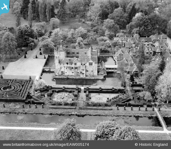
EAW005174 ENGLAND (1947). Hever Castle and the Tudor Gardens, Hever, 1947
© Copyright OpenStreetMap contributors and licensed by the OpenStreetMap Foundation. 2026. Cartography is licensed as CC BY-SA.
Nearby Images (7)
EAW005174

EAW005176

EAW005175

EAW005177

EAW005178

EAW005179

EAW005180

Details
| Title | [EAW005174] Hever Castle and the Tudor Gardens, Hever, 1947 |
| Reference | EAW005174 |
| Date | 9-May-1947 |
| Link | |
| Place name | HEVER |
| Parish | HEVER |
| District | |
| Country | ENGLAND |
| Easting / Northing | 547831, 145210 |
| Longitude / Latitude | 0.11556174884898, 51.186454108041 |
| National Grid Reference | TQ478452 |
