
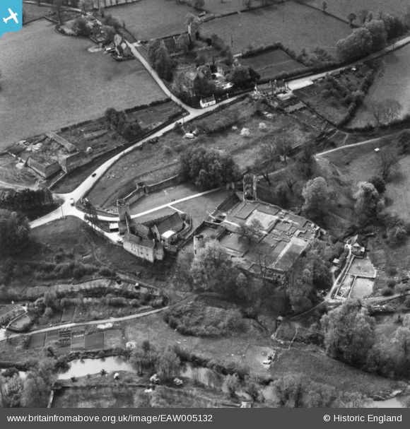
EAW005132 ENGLAND (1947). Farleigh Castle, Farleigh Hungerford, 1947. This image has been produced from a print.
© Copyright OpenStreetMap contributors and licensed by the OpenStreetMap Foundation. 2026. Cartography is licensed as CC BY-SA.
Nearby Images (6)
EAW005132

EAW005130

EAW005129

EAW005131

EAW005133

EAW005134

Details
| Title | [EAW005132] Farleigh Castle, Farleigh Hungerford, 1947. This image has been produced from a print. |
| Reference | EAW005132 |
| Date | 7-September-1947 |
| Link | |
| Place name | FARLEIGH HUNGERFORD |
| Parish | NORTON ST. PHILIP |
| District | |
| Country | ENGLAND |
| Easting / Northing | 380097, 157611 |
| Longitude / Latitude | -2.2856179544601, 51.316754678164 |
| National Grid Reference | ST801576 |
Pins
Be the first to add a comment to this image!