
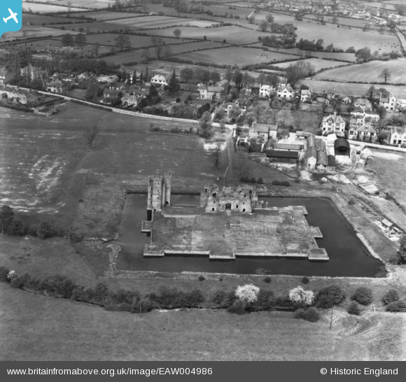
EAW004986 ENGLAND (1947). Kirby Muxloe Castle, Kirby Muxloe, 1947. This image has been produced from a print.
© Copyright OpenStreetMap contributors and licensed by the OpenStreetMap Foundation. 2024. Cartography is licensed as CC BY-SA.
Nearby Images (7)
EAW004986

EPW055012

EAW004983

EAW004982

EAW004984

EAW004981

EAW004985

Details
| Title | [EAW004986] Kirby Muxloe Castle, Kirby Muxloe, 1947. This image has been produced from a print. |
| Reference | EAW004986 |
| Date | 7-May-1947 |
| Link | |
| Place name | KIRBY MUXLOE |
| Parish | KIRBY MUXLOE |
| District | |
| Country | ENGLAND |
| Easting / Northing | 452344, 304619 |
| Longitude / Latitude | -1.2264320572314, 52.636440675776 |
| National Grid Reference | SK523046 |
Pins
Be the first to add a comment to this image!