
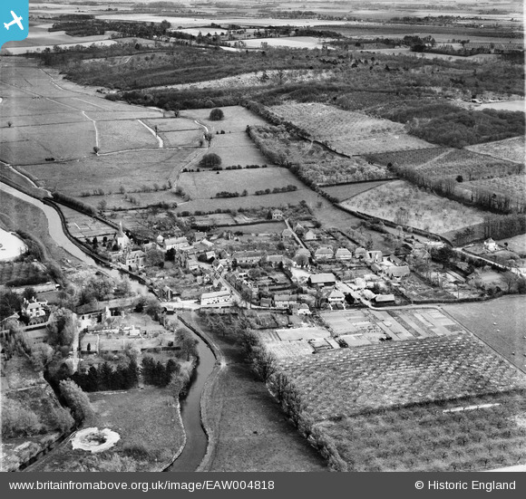
EAW004818 ENGLAND (1947). The town, Fordwich, from the west, 1947
© Copyright OpenStreetMap contributors and licensed by the OpenStreetMap Foundation. 2026. Cartography is licensed as CC BY-SA.
Nearby Images (4)
EAW004818

EAW004817

EAW004816

EAW004814

Details
| Title | [EAW004818] The town, Fordwich, from the west, 1947 |
| Reference | EAW004818 |
| Date | 25-April-1947 |
| Link | |
| Place name | FORDWICH |
| Parish | FORDWICH |
| District | |
| Country | ENGLAND |
| Easting / Northing | 617856, 159739 |
| Longitude / Latitude | 1.1251661458164, 51.294525899993 |
| National Grid Reference | TR179597 |
Pins

Matt Aldred edob.mattaldred.com |
Saturday 1st of March 2025 10:50:57 PM | |

Sparky |
Friday 6th of October 2017 06:25:56 PM | |

totoro |
Wednesday 11th of December 2013 10:30:37 PM | |
|
totoro |
Wednesday 11th of December 2013 10:28:40 PM | |
|
totoro |
Wednesday 11th of December 2013 10:21:37 PM | |
|
totoro |
Wednesday 11th of December 2013 10:21:13 PM | |
|
totoro |
Wednesday 11th of December 2013 10:20:17 PM | |
|
totoro |
Wednesday 11th of December 2013 10:19:14 PM | |
|
totoro |
Wednesday 11th of December 2013 10:18:42 PM | |
|
totoro |
Wednesday 11th of December 2013 10:18:00 PM | |
 |
totoro |
Wednesday 11th of December 2013 10:16:25 PM |
|
totoro |
Wednesday 11th of December 2013 10:13:04 PM |