
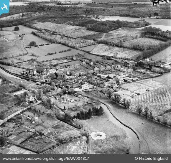
EAW004817 ENGLAND (1947). The town, Fordwich, from the north-west, 1947
© Copyright OpenStreetMap contributors and licensed by the OpenStreetMap Foundation. 2026. Cartography is licensed as CC BY-SA.
Nearby Images (4)
EAW004817

EAW004816

EAW004818

EAW004814

Details
| Title | [EAW004817] The town, Fordwich, from the north-west, 1947 |
| Reference | EAW004817 |
| Date | 25-April-1947 |
| Link | |
| Place name | FORDWICH |
| Parish | FORDWICH |
| District | |
| Country | ENGLAND |
| Easting / Northing | 617886, 159820 |
| Longitude / Latitude | 1.1256452481112, 51.295241755433 |
| National Grid Reference | TR179598 |
Pins

Sparky |
Friday 6th of October 2017 06:24:53 PM | |

totoro |
Wednesday 11th of December 2013 10:56:56 PM | |
|
totoro |
Wednesday 11th of December 2013 10:55:55 PM | |
|
totoro |
Wednesday 11th of December 2013 10:54:56 PM | |
|
totoro |
Wednesday 11th of December 2013 10:53:52 PM | |
|
totoro |
Wednesday 11th of December 2013 10:52:15 PM | |
|
totoro |
Wednesday 11th of December 2013 10:50:51 PM | |
|
JimP |
Wednesday 30th of October 2013 05:54:38 PM |