
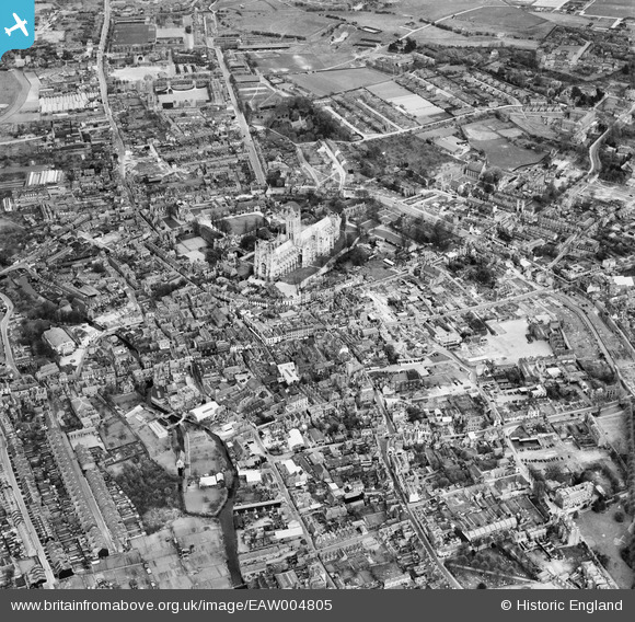
EAW004805 ENGLAND (1947). The city centre, Canterbury, from the south-west, 1947
© Copyright OpenStreetMap contributors and licensed by the OpenStreetMap Foundation. 2026. Cartography is licensed as CC BY-SA.
Nearby Images (8)
EAW004805

EPW018612

EAW014335

EAW004804

EAW017600

EPW000394

EPW009143

EAW014336

Details
| Title | [EAW004805] The city centre, Canterbury, from the south-west, 1947 |
| Reference | EAW004805 |
| Date | 25-April-1947 |
| Link | |
| Place name | CANTERBURY |
| Parish | |
| District | |
| Country | ENGLAND |
| Easting / Northing | 614766, 157701 |
| Longitude / Latitude | 1.0796835900946, 51.277398855796 |
| National Grid Reference | TR148577 |
Pins

colonelflay |
Friday 28th of October 2022 01:30:06 AM | |
|
RayG |
Wednesday 27th of October 2021 11:09:53 PM | |

Sparky |
Friday 24th of November 2017 08:09:23 AM | |
|
Sparky |
Friday 4th of August 2017 03:09:41 PM | |
|
The Laird |
Sunday 5th of July 2015 12:32:48 PM | |
|
The Laird |
Tuesday 9th of June 2015 09:47:36 PM | |
|
The Laird |
Tuesday 9th of June 2015 09:45:43 PM | |
|
The Laird |
Tuesday 9th of June 2015 09:41:53 PM | |
|
The Laird |
Tuesday 9th of June 2015 09:41:15 PM | |
|
The Laird |
Tuesday 9th of June 2015 09:40:28 PM | |
|
The Laird |
Tuesday 9th of June 2015 09:34:26 PM | |
|
The Laird |
Tuesday 9th of June 2015 09:33:22 PM | |

Alan McFaden |
Thursday 10th of July 2014 01:27:40 PM | |
|
Alan McFaden |
Thursday 10th of July 2014 01:27:10 PM | |
|
Alan McFaden |
Thursday 10th of July 2014 01:26:23 PM | |
|
Alan McFaden |
Thursday 10th of July 2014 01:25:46 PM | |
|
Alan McFaden |
Thursday 10th of July 2014 01:25:16 PM |


