
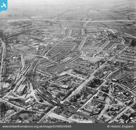
EAW004668 ENGLAND (1947). Friargate and environs, Derby, from the east, 1947
© Copyright OpenStreetMap contributors and licensed by the OpenStreetMap Foundation. 2026. Cartography is licensed as CC BY-SA.
Nearby Images (6)
EAW004668

EAW004671

EAW004667

EAW004670

EAW044086

EAW044085

Details
| Title | [EAW004668] Friargate and environs, Derby, from the east, 1947 |
| Reference | EAW004668 |
| Date | 22-April-1947 |
| Link | |
| Place name | DERBY |
| Parish | |
| District | |
| Country | ENGLAND |
| Easting / Northing | 434564, 336455 |
| Longitude / Latitude | -1.4858178865098, 52.924076414643 |
| National Grid Reference | SK346365 |
Pins

redmist |
Wednesday 25th of October 2023 09:10:11 PM | |
|
HelsyB |
Saturday 10th of April 2021 04:18:37 AM | |
|
HelsyB |
Saturday 10th of April 2021 04:16:49 AM | |
|
almoffat |
Tuesday 11th of March 2014 10:04:00 PM | |
|
almoffat |
Tuesday 11th of March 2014 10:01:25 PM | |
|
almoffat |
Tuesday 11th of March 2014 09:59:31 PM | |
|
almoffat |
Tuesday 11th of March 2014 09:58:11 PM | |
|
almoffat |
Tuesday 11th of March 2014 09:53:57 PM | |
|
almoffat |
Tuesday 11th of March 2014 09:52:50 PM | |
|
almoffat |
Tuesday 11th of March 2014 09:51:31 PM | |
|
almoffat |
Tuesday 11th of March 2014 09:49:53 PM |