
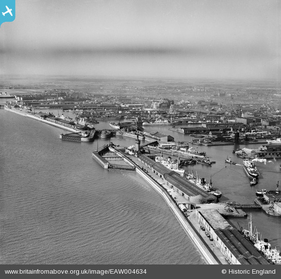
EAW004634 ENGLAND (1947). Canada Basin, Canada Dock and environs, Liverpool, from the south, 1947
© Copyright OpenStreetMap contributors and licensed by the OpenStreetMap Foundation. 2026. Cartography is licensed as CC BY-SA.
Nearby Images (6)
EAW004634

EPW018902

EAW001706

EPW051519

EPW011237

EAW023371

Details
| Title | [EAW004634] Canada Basin, Canada Dock and environs, Liverpool, from the south, 1947 |
| Reference | EAW004634 |
| Date | 17-April-1947 |
| Link | |
| Place name | LIVERPOOL |
| Parish | |
| District | |
| Country | ENGLAND |
| Easting / Northing | 333118, 393727 |
| Longitude / Latitude | -3.006876078747, 53.435817435565 |
| National Grid Reference | SJ331937 |
Pins

rivermersey |
Sunday 14th of January 2024 10:23:57 PM | |
|
redmist |
Saturday 13th of February 2021 12:20:17 PM |