
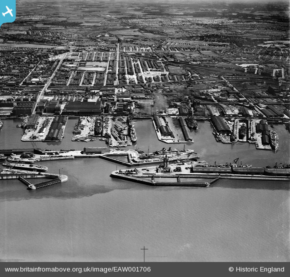
EAW001706 ENGLAND (1946). Canada Dock and Basin and environs, Liverpool, from the west, 1946
© Copyright OpenStreetMap contributors and licensed by the OpenStreetMap Foundation. 2026. Cartography is licensed as CC BY-SA.
Nearby Images (5)
EAW001706

EPW011237

EPW018902

EAW004634

EPW051519

Details
| Title | [EAW001706] Canada Dock and Basin and environs, Liverpool, from the west, 1946 |
| Reference | EAW001706 |
| Date | 11-July-1946 |
| Link | |
| Place name | LIVERPOOL |
| Parish | |
| District | |
| Country | ENGLAND |
| Easting / Northing | 333043, 393921 |
| Longitude / Latitude | -3.0080462444332, 53.437551618309 |
| National Grid Reference | SJ330939 |
Pins

redmist |
Monday 12th of August 2024 03:46:47 PM | |

Ginger79 |
Wednesday 10th of July 2024 12:51:49 AM | |
|
redmist |
Saturday 13th of February 2021 11:44:56 AM | |
|
stephen doherty |
Friday 13th of March 2020 04:57:53 PM | |
|
redmist |
Friday 29th of March 2019 12:07:57 AM | |
|
redmist |
Friday 29th of March 2019 12:00:38 AM | |
|
redmist |
Thursday 28th of March 2019 11:55:57 PM | |
|
Davy |
Saturday 17th of December 2016 11:43:11 AM | |
|
Davy |
Saturday 17th of December 2016 11:40:36 AM | |
|
Davy |
Saturday 17th of December 2016 11:34:38 AM | |
|
Davy |
Saturday 17th of December 2016 11:18:23 AM |