
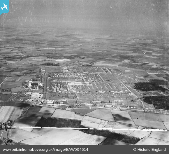
EAW004614 ENGLAND (1947). Former Royal Ordnance Factory Kirkby (Knowsley Industrial Park), Kirkby, from the south-west, 1947. This image was marked by Aerofilms Ltd for photo editing.
© Copyright OpenStreetMap contributors and licensed by the OpenStreetMap Foundation. 2026. Cartography is licensed as CC BY-SA.
Nearby Images (4)
EAW004614
, Kirkby, from the south-west, 1947. This image was marked by Aerofilms Ltd for photo editing.")
EAW004615
, Kirkby, from the south, 1947")
EAW046999

EAW046997

Details
| Title | [EAW004614] Former Royal Ordnance Factory Kirkby (Knowsley Industrial Park), Kirkby, from the south-west, 1947. This image was marked by Aerofilms Ltd for photo editing. |
| Reference | EAW004614 |
| Date | 17-April-1947 |
| Link | |
| Place name | KIRKBY |
| Parish | |
| District | |
| Country | ENGLAND |
| Easting / Northing | 343042, 398007 |
| Longitude / Latitude | -2.8582704448081, 53.475454053317 |
| National Grid Reference | SJ430980 |
Pins

Lord Axminister |
Sunday 14th of December 2025 11:11:12 PM | |
|
BARB |
Wednesday 6th of December 2023 11:29:37 PM | |
|
rivermersey |
Tuesday 30th of November 2021 01:02:55 PM | |

Matt Aldred edob.mattaldred.com |
Monday 8th of March 2021 09:22:54 PM | |
|
Matt Aldred edob.mattaldred.com |
Monday 8th of March 2021 09:22:40 PM | |
|
Matt Aldred edob.mattaldred.com |
Monday 8th of March 2021 09:22:26 PM | |
|
Matt Aldred edob.mattaldred.com |
Monday 8th of March 2021 09:22:08 PM | |
|
austin |
Thursday 4th of February 2021 08:38:45 PM | |
|
austin |
Thursday 4th of February 2021 08:38:45 PM | |
|
cptpies |
Tuesday 5th of May 2020 12:37:21 PM | |
|
cptpies |
Tuesday 5th of May 2020 12:36:51 PM | |
|
cptpies |
Tuesday 5th of May 2020 12:36:28 PM |