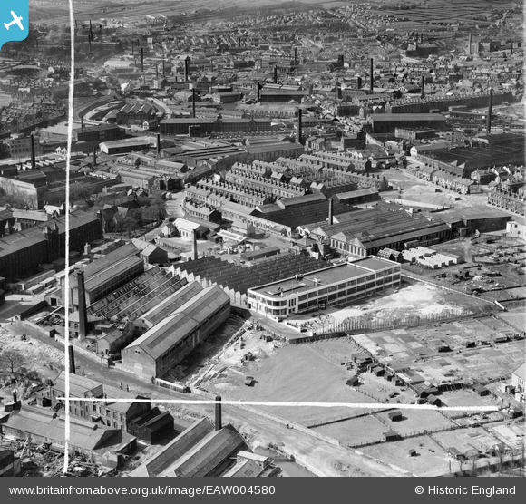
EAW004580 ENGLAND (1947). Dryart Mills and environs, Keighley, 1947. This image was marked by Aerofilms Ltd for photo editing.
© Copyright OpenStreetMap contributors and licensed by the OpenStreetMap Foundation. 2025. Cartography is licensed as CC BY-SA.
Nearby Images (9)
EAW004580

EAW004581

EAW004582

EAW004586

EAW004585

EAW004587

EPW003326

EAW004584

EAW004583

Details
| Title | [EAW004580] Dryart Mills and environs, Keighley, 1947. This image was marked by Aerofilms Ltd for photo editing. |
| Reference | EAW004580 |
| Date | 17-April-1947 |
| Link | |
| Place name | KEIGHLEY |
| Parish | KEIGHLEY |
| District | |
| Country | ENGLAND |
| Easting / Northing | 406863, 441484 |
| Longitude / Latitude | -1.8956171112829, 53.869313987238 |
| National Grid Reference | SE069415 |
Pins
 Sparky |
Friday 29th of September 2017 08:03:48 AM | |
John W |
Friday 10th of June 2016 10:08:56 PM | |
 Class31 |
Tuesday 14th of October 2014 08:43:18 PM | |
Class31 |
Tuesday 14th of October 2014 08:39:29 PM | |
Class31 |
Tuesday 14th of October 2014 08:37:08 PM | |
Class31 |
Tuesday 14th of October 2014 08:35:05 PM | |
Class31 |
Tuesday 14th of October 2014 08:33:59 PM | |
Class31 |
Tuesday 14th of October 2014 08:32:28 PM | |
Class31 |
Tuesday 14th of October 2014 08:31:29 PM |