
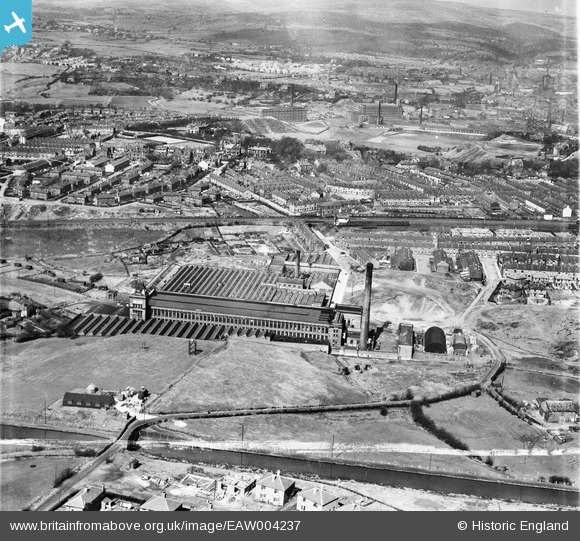
EAW004237 ENGLAND (1947). Valley Ring and Union Ring Cotton Mills at Stoneyfield, Rochdale, 1947
© Copyright OpenStreetMap contributors and licensed by the OpenStreetMap Foundation. 2026. Cartography is licensed as CC BY-SA.
Nearby Images (10)
EAW004237

EAW004238

EAW004235

EAW004232

EAW004236

EAW004234

EPW016796

EAW004230

EAW004231

EAW004233

Details
| Title | [EAW004237] Valley Ring and Union Ring Cotton Mills at Stoneyfield, Rochdale, 1947 |
| Reference | EAW004237 |
| Date | 9-April-1947 |
| Link | |
| Place name | ROCHDALE |
| Parish | |
| District | |
| Country | ENGLAND |
| Easting / Northing | 389229, 411871 |
| Longitude / Latitude | -2.1627896417846, 53.603054264902 |
| National Grid Reference | SD892119 |
Pins
Be the first to add a comment to this image!