
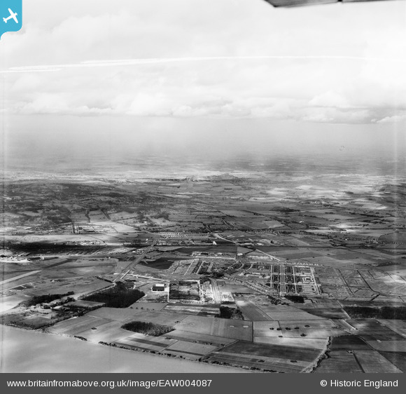
EAW004087 ENGLAND (1947). Speke airfield, Speke and Halewood, Speke, from the south, 1947. This image was marked by Aerofilms Ltd for photo editing.
© Copyright OpenStreetMap contributors and licensed by the OpenStreetMap Foundation. 2026. Cartography is licensed as CC BY-SA.
Nearby Images (4)
EAW004087

EAW047305

EAW004086

EAW047309

Details
| Title | [EAW004087] Speke airfield, Speke and Halewood, Speke, from the south, 1947. This image was marked by Aerofilms Ltd for photo editing. |
| Reference | EAW004087 |
| Date | 25-March-1947 |
| Link | |
| Place name | SPEKE |
| Parish | |
| District | |
| Country | ENGLAND |
| Easting / Northing | 342922, 382640 |
| Longitude / Latitude | -2.8572968132564, 53.337313354111 |
| National Grid Reference | SJ429826 |
Pins

Ange |
Tuesday 8th of July 2025 10:53:11 PM | |
|
DaveH |
Friday 10th of November 2023 09:32:37 PM | |
|
DaveH |
Friday 10th of November 2023 09:30:09 PM | |
|
DaveH |
Friday 10th of November 2023 09:24:22 PM | |

bescotbeast |
Friday 28th of March 2014 04:33:13 PM |