
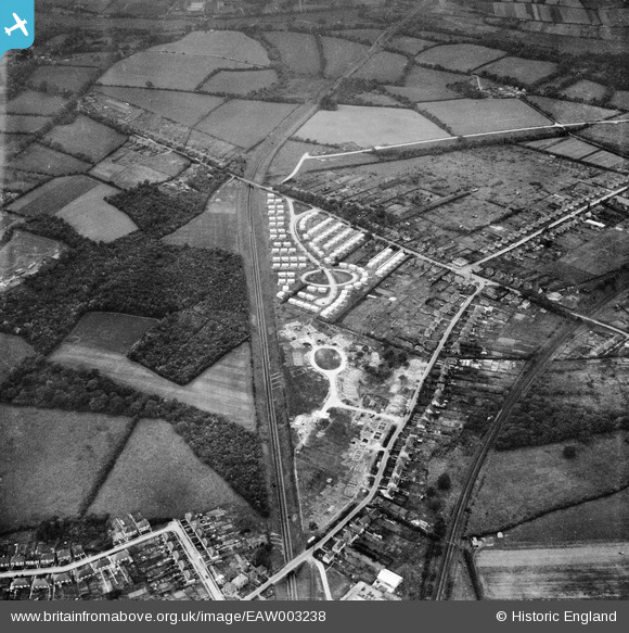
EAW003238 ENGLAND (1946). Construction of prefabricated housing around Stow Crescent, Fareham, 1946
© Copyright OpenStreetMap contributors and licensed by the OpenStreetMap Foundation. 2026. Cartography is licensed as CC BY-SA.
Nearby Images (3)
EAW003238

EAW003236

EAW003234

Details
| Title | [EAW003238] Construction of prefabricated housing around Stow Crescent, Fareham, 1946 |
| Reference | EAW003238 |
| Date | 25-October-1946 |
| Link | |
| Place name | FAREHAM |
| Parish | |
| District | |
| Country | ENGLAND |
| Easting / Northing | 455865, 106850 |
| Longitude / Latitude | -1.2061982031195, 50.857902740574 |
| National Grid Reference | SU559069 |
Pins

ianhenden |
Monday 5th of February 2024 10:54:50 AM | |
|
ianhenden |
Thursday 7th of December 2023 09:21:22 AM | |
|
Paul Bradley |
Tuesday 5th of May 2020 10:37:15 PM | |
|
Josharpr |
Wednesday 1st of April 2020 11:29:23 PM | |
|
Josharpr |
Wednesday 1st of April 2020 11:29:01 PM | |
|
Josharpr |
Monday 15th of April 2019 05:00:37 PM |