
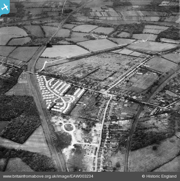
EAW003234 ENGLAND (1946). Hill Park and construction of prefabricated housing around Stow Crescent, Fareham, 1946
© Copyright OpenStreetMap contributors and licensed by the OpenStreetMap Foundation. 2026. Cartography is licensed as CC BY-SA.
Nearby Images (6)
EAW003234

EAW003236

EAW003238

EAW003232

EAW003237

EAW003235

Details
| Title | [EAW003234] Hill Park and construction of prefabricated housing around Stow Crescent, Fareham, 1946 |
| Reference | EAW003234 |
| Date | 25-October-1946 |
| Link | |
| Place name | FAREHAM |
| Parish | |
| District | |
| Country | ENGLAND |
| Easting / Northing | 455699, 107012 |
| Longitude / Latitude | -1.2085320427112, 50.859375565111 |
| National Grid Reference | SU557070 |
Pins

Post-war prefabs |
Saturday 9th of November 2019 08:49:05 AM | |
|
MikePilot&Navigator |
Sunday 28th of September 2014 08:20:57 PM | |
|
MikePilot&Navigator |
Sunday 28th of September 2014 08:19:11 PM | |
|
patsmithuk |
Monday 16th of June 2014 09:27:06 PM | |
|
patsmithuk |
Monday 16th of June 2014 09:25:51 PM | |
|
patsmithuk |
Monday 16th of June 2014 09:13:49 PM | |
|
Mykiemike |
Tuesday 27th of August 2013 09:01:30 PM | |
|
Mykiemike |
Tuesday 27th of August 2013 08:59:31 PM | |
|
Mykiemike |
Tuesday 27th of August 2013 08:59:07 PM |
User Comment Contributions
the circle in the field below stow estate is the outline of Hammond road before it was built. |
patsmithuk |
Monday 16th of June 2014 09:12:58 PM |