
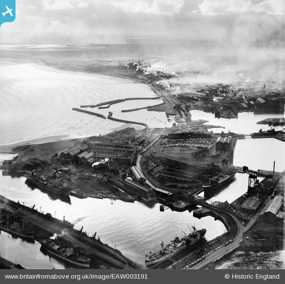
EAW003191 ENGLAND (1946). The Hartlepool Engine Works and the surrounding harbour, Hartlepool, from the north, 1946
© Copyright OpenStreetMap contributors and licensed by the OpenStreetMap Foundation. 2026. Cartography is licensed as CC BY-SA.
Nearby Images (11)
EAW003191

EAW003186

EAW003185

EAW003192

EPW054633

EPW054634

EAW003203

EPW054635

EAW003187

EAW003190

EPW010608

Details
| Title | [EAW003191] The Hartlepool Engine Works and the surrounding harbour, Hartlepool, from the north, 1946 |
| Reference | EAW003191 |
| Date | 23-October-1946 |
| Link | |
| Place name | HARTLEPOOL |
| Parish | |
| District | |
| Country | ENGLAND |
| Easting / Northing | 452004, 533933 |
| Longitude / Latitude | -1.1930076032237, 54.6976308785 |
| National Grid Reference | NZ520339 |
Pins

redmist |
Friday 30th of September 2022 02:17:40 PM | |
|
redmist |
Friday 30th of September 2022 02:15:49 PM | |
|
redmist |
Tuesday 22nd of September 2020 10:36:10 PM | |
|
redmist |
Tuesday 22nd of September 2020 10:33:24 PM | |
|
redmist |
Tuesday 22nd of September 2020 10:32:49 PM | |
|
redmist |
Tuesday 22nd of September 2020 10:32:22 PM |