
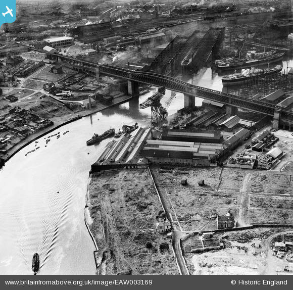
EAW003169 ENGLAND (1946). The Richardsons, Westgarth and Co Marine Engineering Works (G. Clark Ltd) alongside the Queen Alexandra Bridge, Sunderland, 1946
© Copyright OpenStreetMap contributors and licensed by the OpenStreetMap Foundation. 2026. Cartography is licensed as CC BY-SA.
Nearby Images (15)
EAW003169
 alongside the Queen Alexandra Bridge, Sunderland, 1946")
EAW003163
, Sunderland, 1946")
EAW003150
 alongside Queen Alexandra Bridge, Sunderland, from the north-east, 1946")
EAW003154
, Queen Alexandra Bridge and the surrounding industrial area, Sunderland, 1946")
EAW003164
, Sunderland, from the south-east, 1946")
EAW003168
 and the surrounding residential area, Sunderland, 1946")
EAW003167
 alongside Queen Alexandra Bridge, Sunderland, 1946")
EAW001032

EAW003162
 and the surrounding industrial area, Sunderland, from the west, 1946")
EAW003165
, Sunderland, 1946")
EAW003153
, Queen Alexandra Bridge and the surrounding industrial area, Sunderland, 1946")
EAW003155
, Queen Alexandra Bridge and the surrounding area, Sunderland, 1946")
EAW003166
 alongside Queen Alexandra Bridge, Sunderland, 1946")
EPW054629

EAW003152
, Queen Alexandra Bridge and the surrounding residential area, Sunderland, 1946")
Details
| Title | [EAW003169] The Richardsons, Westgarth and Co Marine Engineering Works (G. Clark Ltd) alongside the Queen Alexandra Bridge, Sunderland, 1946 |
| Reference | EAW003169 |
| Date | 23-October-1946 |
| Link | |
| Place name | SUNDERLAND |
| Parish | |
| District | |
| Country | ENGLAND |
| Easting / Northing | 438308, 557946 |
| Longitude / Latitude | -1.402349221483, 54.914664781113 |
| National Grid Reference | NZ383579 |
Pins

Matt Aldred edob.mattaldred.com |
Thursday 19th of May 2022 02:14:24 PM | |

Alan |
Tuesday 2nd of January 2018 06:05:19 PM |