
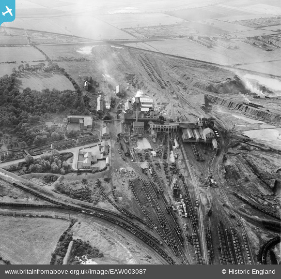
EAW003087 ENGLAND (1946). Bentley Colliery, Bentley, 1946
© Copyright OpenStreetMap contributors and licensed by the OpenStreetMap Foundation. 2026. Cartography is licensed as CC BY-SA.
Nearby Images (7)
EAW003087

EAW003084

EAW003088

EAW003085

EAW003083

EAW003086

EAW003089

Details
| Title | [EAW003087] Bentley Colliery, Bentley, 1946 |
| Reference | EAW003087 |
| Date | 8-October-1946 |
| Link | |
| Place name | BENTLEY |
| Parish | |
| District | |
| Country | ENGLAND |
| Easting / Northing | 456986, 407447 |
| Longitude / Latitude | -1.1395902481139, 53.560301728985 |
| National Grid Reference | SE570074 |
Pins

MikeMist |
Tuesday 22nd of April 2014 03:41:50 PM | |
|
MikeMist |
Tuesday 22nd of April 2014 02:36:39 PM | |
|
MikeMist |
Tuesday 22nd of April 2014 02:35:22 PM | |
|
MikeMist |
Tuesday 22nd of April 2014 02:31:38 PM | |
|
MikeMist |
Tuesday 22nd of April 2014 02:30:51 PM | |
|
MikeMist |
Tuesday 22nd of April 2014 02:29:15 PM | |
|
MikeMist |
Tuesday 22nd of April 2014 02:26:20 PM |