
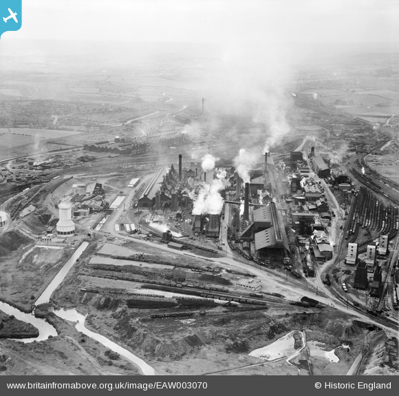
EAW003070 ENGLAND (1946). The Devonshire Works and environs, Staveley, from the east, 1946
© Copyright OpenStreetMap contributors and licensed by the OpenStreetMap Foundation. 2026. Cartography is licensed as CC BY-SA.
Nearby Images (17)
EAW003070

EPW041674

EAW009691

EAW003064

EPW057347

EPW041680

EAW009690

EAW044346

EPW057332

EPW057346

EPW057344

EPW057339

EPW041676

EAW003063

EAW003067

EPW041675

EAW003071

Details
| Title | [EAW003070] The Devonshire Works and environs, Staveley, from the east, 1946 |
| Reference | EAW003070 |
| Date | 8-October-1946 |
| Link | |
| Place name | STAVELEY |
| Parish | STAVELEY |
| District | |
| Country | ENGLAND |
| Easting / Northing | 442679, 374829 |
| Longitude / Latitude | -1.3600058460374, 53.26845640694 |
| National Grid Reference | SK427748 |
Pins
Be the first to add a comment to this image!