
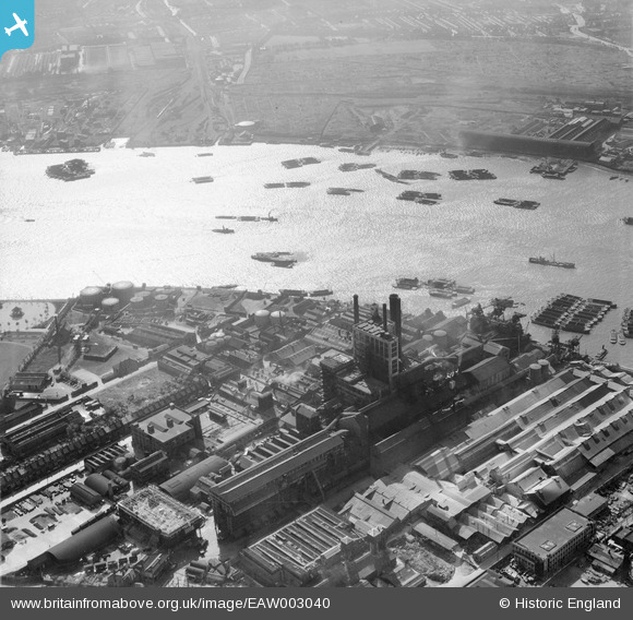
EAW003040 ENGLAND (1946). The Tate & Lyle Sugar Refinery, surrounding industry and the River Thames, Silvertown, 1946
© Copyright OpenStreetMap contributors and licensed by the OpenStreetMap Foundation. 2026. Cartography is licensed as CC BY-SA.
Nearby Images (48)
EAW003040

EAW003038

EAW001404

EAW001410

EAW028140

EAW001411

EAW001408

EAW007280

EAW007213

EAW001406

EAW028136

EAW001409

EAW001405

EAW001407

EAW003042

EAW003037

EAW028134

EAW007216

EAW003041

EAW028143

EAW028135

EAW034535

EAW034537

EAW034539

EAW034538

EAW003045

EAW034540

EAW028141

EAW007279

EAW034529

EAW034536

EAW034533

EAW003039

EPW007186

EAW034532

EAW034534

EAW034530

EAW034531

EPW007187

EAW007219

EAW003046

EAW007214

EAW007215

EAW028138

EAW007209

EAW007210

EAW007208

EAW007220

Details
| Title | [EAW003040] The Tate & Lyle Sugar Refinery, surrounding industry and the River Thames, Silvertown, 1946 |
| Reference | EAW003040 |
| Date | 10-October-1946 |
| Link | |
| Place name | SILVERTOWN |
| Parish | |
| District | |
| Country | ENGLAND |
| Easting / Northing | 540229, 179800 |
| Longitude / Latitude | 0.020473956966585, 51.499236914431 |
| National Grid Reference | TQ402798 |
Pins

John W |
Saturday 4th of February 2017 06:22:06 PM |