
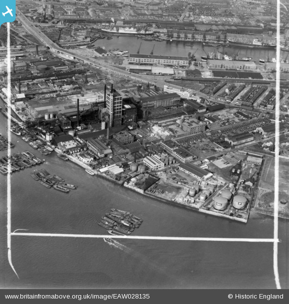
EAW028135 ENGLAND (1950). The industrial area between Silvertown Way and the River Thames, Silvertown, 1950. This image has been produced from a print marked by Aerofilms Ltd for photo editing.
© Copyright OpenStreetMap contributors and licensed by the OpenStreetMap Foundation. 2026. Cartography is licensed as CC BY-SA.
Nearby Images (48)
EAW028136

EAW007216

EAW001408

EAW001411

EAW028140

EAW007213

EAW028143

EPW007187

EAW034538

EAW034540

EPW007186

EAW001410

EAW034529

EAW028134

EAW034539

EAW034532

EAW001404

EAW007209

EAW034530

EAW034536

EAW034533

EAW034531

EAW007210

EAW034537

EAW034535

EAW034534

EAW007208

EAW007219

EAW003040

EAW007215

EAW007220

EAW003038

EAW007218

EAW007212

EAW007214

EAW007217

EAW007211

EPW046556

EPW008580

EPW046557

EPW046558

EPW046559

EAW007280

EPW046555

EPW046554

EPW008574

EPW059927

EAW007279

Details
| Title | [EAW028135] The industrial area between Silvertown Way and the River Thames, Silvertown, 1950. This image has been produced from a print marked by Aerofilms Ltd for photo editing. |
| Reference | EAW028135 |
| Date | 15-March-1950 |
| Link | |
| Place name | SILVERTOWN |
| Parish | |
| District | |
| Country | ENGLAND |
| Easting / Northing | 540319, 179921 |
| Longitude / Latitude | 0.021817978017607, 51.500301991847 |
| National Grid Reference | TQ403799 |
Pins
Be the first to add a comment to this image!