
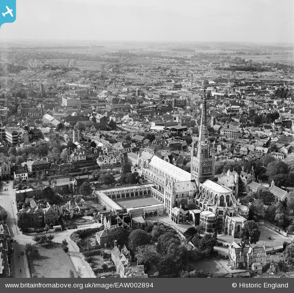
EAW002894 ENGLAND (1946). Norwich Cathedral and the city centre, Norwich, from the east, 1946
© Copyright OpenStreetMap contributors and licensed by the OpenStreetMap Foundation. 2026. Cartography is licensed as CC BY-SA.
Nearby Images (31)
EAW002894

EAW036855

EAW001933

EPW006606

EAW008201

EPW006607

EAW036841

EPW039748

EPW021205

EPW021211

EAW005079

EPW006608

EAW005078

EAW036838

EAW036852

EAW001934

EPW021220

EAW036854

EAW001931

EAW001932

EAW036840

EAW036839

EAW036834

EPW021218

EAW036850

EAW036851

EAW002892

EAW036849

EAW036837

EPW001973

EAW001952

Details
| Title | [EAW002894] Norwich Cathedral and the city centre, Norwich, from the east, 1946 |
| Reference | EAW002894 |
| Date | 1-October-1946 |
| Link | |
| Place name | NORWICH |
| Parish | |
| District | |
| Country | ENGLAND |
| Easting / Northing | 623501, 308873 |
| Longitude / Latitude | 1.3030753702703, 52.631157214211 |
| National Grid Reference | TG235089 |
Pins

Sparky |
Saturday 16th of September 2017 03:06:49 PM | |

peteabove |
Tuesday 20th of January 2015 01:29:14 PM | |

Alan McFaden |
Wednesday 13th of November 2013 09:23:26 PM | |
|
Alan McFaden |
Wednesday 13th of November 2013 09:22:44 PM |


User Comment Contributions
Site of Robert Stevenson Limited Structural Steel Drawing Office until the move to new premises off Sandy Lane (Hall Road area). |
peteabove |
Tuesday 20th of January 2015 01:28:39 PM |