
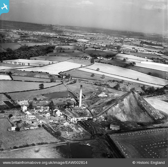
EAW002814 ENGLAND (1946). The Cotes Park Colliery, Cotes Park, from the south-west, 1946
© Copyright OpenStreetMap contributors and licensed by the OpenStreetMap Foundation. 2026. Cartography is licensed as CC BY-SA.
Nearby Images (14)
EAW002814

EAW003276

EAW003286

EAW003280

EAW002813

EAW003278

EAW003277

EAW003282

EAW002812

EAW003285

EAW003284

EAW003283

EAW003279

EAW003281

Details
| Title | [EAW002814] The Cotes Park Colliery, Cotes Park, from the south-west, 1946 |
| Reference | EAW002814 |
| Date | 27-September-1946 |
| Link | |
| Place name | COTES PARK |
| Parish | SOMERCOTES |
| District | |
| Country | ENGLAND |
| Easting / Northing | 442608, 354942 |
| Longitude / Latitude | -1.3637214713682, 53.0896901325 |
| National Grid Reference | SK426549 |
Pins

dd1000 |
Wednesday 17th of July 2019 09:11:25 PM | |
|
dd1000 |
Wednesday 17th of July 2019 09:09:40 PM | |
|
dd1000 |
Wednesday 17th of July 2019 09:08:51 PM | |
|
dd1000 |
Wednesday 17th of July 2019 09:08:21 PM | |
Red lane |
dd1000 |
Wednesday 17th of July 2019 09:40:33 PM |

todd2zappa |
Friday 12th of July 2019 05:30:56 PM | |
Could you send google earth coordinates please. |
dd1000 |
Wednesday 17th of July 2019 09:38:29 PM |