
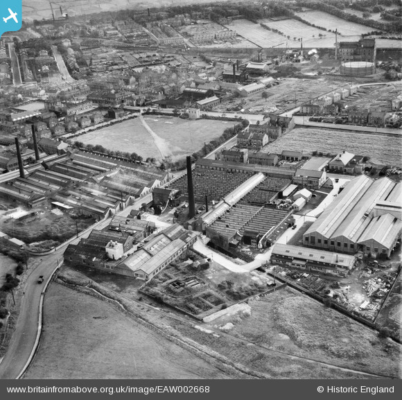
EAW002668 ENGLAND (1946). The Scandinavia Textile Belting Mills, Hunsworth Lane and the surrounding area, Cleckheaton, 1946
© Copyright OpenStreetMap contributors and licensed by the OpenStreetMap Foundation. 2025. Cartography is licensed as CC BY-SA.
Nearby Images (19)
EAW002668

EAW002669

EPW040820

EPW040826

EPW040822

EPW040824

EAW002666

EPW040819

EPW040823

EPW040821

EAW002667

EAW002670

EPW048012
 and Recreation Ground, Cleckheaton, 1935")
EPW048006
 and Recreation Ground, Cleckheaton, 1935")
EPW048011
 and Recreation Ground, Cleckheaton, 1935")
EPW048008
 and Recreation Ground, Cleckheaton, 1935")
EPW048007
 and Recreation Ground, Cleckheaton, 1935")
EPW048010
 and Recreation Ground, Cleckheaton, 1935")
EPW048009
, Cleckheaton, 1935")
Details
| Title | [EAW002668] The Scandinavia Textile Belting Mills, Hunsworth Lane and the surrounding area, Cleckheaton, 1946 |
| Reference | EAW002668 |
| Date | 19-September-1946 |
| Link | |
| Place name | CLECKHEATON |
| Parish | |
| District | |
| Country | ENGLAND |
| Easting / Northing | 418654, 426334 |
| Longitude / Latitude | -1.7172011722358, 53.732842248713 |
| National Grid Reference | SE187263 |
Pins

Chris J |
Sunday 2nd of April 2023 11:42:20 AM | |
|
Chris J |
Sunday 2nd of April 2023 11:38:45 AM | |
|
Chris J |
Sunday 2nd of April 2023 11:33:36 AM | |
|
Chris J |
Sunday 2nd of April 2023 11:30:26 AM | |
|
Chris J |
Sunday 2nd of April 2023 11:27:42 AM | |
|
Chris J |
Sunday 2nd of April 2023 11:21:34 AM | |
|
Chris J |
Sunday 2nd of April 2023 11:20:50 AM | |
|
Chris J |
Sunday 2nd of April 2023 11:19:41 AM | |
|
redmist |
Monday 21st of October 2019 07:40:30 PM |