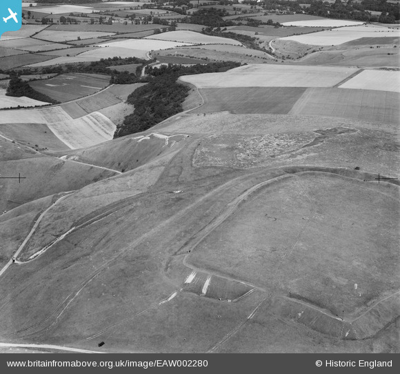
EAW002280 ENGLAND (1946). Uffington Castle and the Uffington White Horse, Uffington, 1946
    © Copyright OpenStreetMap contributors and licensed by the OpenStreetMap Foundation. 2025. Cartography is licensed as CC BY-SA.
  
Details
| Title | [EAW002280] Uffington Castle and the Uffington White Horse, Uffington, 1946 | 
| Reference | EAW002280 | 
| Date | 18-August-1946 | 
| Link | |
| Place name | UFFINGTON | 
| Parish | UFFINGTON | 
| District | |
| Country | ENGLAND | 
| Easting / Northing | 430001, 186477 | 
| Longitude / Latitude | -1.5670264244432, 51.575884396275 | 
| National Grid Reference | SU300865 | 
Pins
Be the first to add a comment to this image!
 
             
  ![[EAW002280] Uffington Castle and the Uffington White Horse, Uffington, 1946](http://britainfromabove.org.uk/sites/all/libraries/aerofilms-images/public/100x100/EAW/002/EAW002280.jpg) 
  
                                          ![[EAW002281] Uffington Castle, Uffington, 1946](http://britainfromabove.org.uk/sites/all/libraries/aerofilms-images/public/100x100/EAW/002/EAW002281.jpg) 
 ![[EAW002279] Dragonhill Road and the Uffington White Horse, Uffington, 1946](http://britainfromabove.org.uk/sites/all/libraries/aerofilms-images/public/100x100/EAW/002/EAW002279.jpg) 
 ![[EAW002384] The Uffington White Horse looking along the Ridge Way, Uffington, from the north-west, 1946](http://britainfromabove.org.uk/sites/all/libraries/aerofilms-images/public/100x100/EAW/002/EAW002384.jpg)