
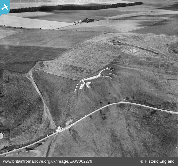
EAW002279 ENGLAND (1946). Dragonhill Road and the Uffington White Horse, Uffington, 1946
© Copyright OpenStreetMap contributors and licensed by the OpenStreetMap Foundation. 2026. Cartography is licensed as CC BY-SA.
Nearby Images (3)
EAW002279

EAW002384

EAW002280

Details
| Title | [EAW002279] Dragonhill Road and the Uffington White Horse, Uffington, 1946 |
| Reference | EAW002279 |
| Date | 18-August-1946 |
| Link | |
| Place name | UFFINGTON |
| Parish | UFFINGTON |
| District | |
| Country | ENGLAND |
| Easting / Northing | 430134, 186639 |
| Longitude / Latitude | -1.5650931284317, 51.577334025177 |
| National Grid Reference | SU301866 |
Pins
Be the first to add a comment to this image!