
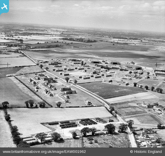
EAW001962 ENGLAND (1946). RAF Horsham St Faith, Norwich, from the south-east, 1946. This image has been produced from a damaged negative.
© Copyright OpenStreetMap contributors and licensed by the OpenStreetMap Foundation. 2026. Cartography is licensed as CC BY-SA.
Nearby Images (9)
EAW001962

EAW002908

EAW002907

EAW001963

EAW001958

EAW002905

EAW002909

EAW001957

EAW002912

Details
| Title | [EAW001962] RAF Horsham St Faith, Norwich, from the south-east, 1946. This image has been produced from a damaged negative. |
| Reference | EAW001962 |
| Date | 25-July-1946 |
| Link | |
| Place name | NORWICH |
| Parish | |
| District | |
| Country | ENGLAND |
| Easting / Northing | 622542, 312371 |
| Longitude / Latitude | 1.2912869535611, 52.662948960903 |
| National Grid Reference | TG225124 |
Pins

Matt Aldred edob.mattaldred.com |
Sunday 16th of February 2025 12:51:21 PM | |

redmist |
Tuesday 23rd of November 2021 07:55:00 PM | |
|
redmist |
Tuesday 23rd of November 2021 07:54:29 PM | |
|
redmist |
Tuesday 23rd of November 2021 07:50:12 PM | |
|
Matt Aldred edob.mattaldred.com |
Tuesday 24th of November 2020 10:23:14 PM | |
|
Matt Aldred edob.mattaldred.com |
Tuesday 24th of November 2020 10:22:58 PM | |
|
Matt Aldred edob.mattaldred.com |
Tuesday 24th of November 2020 10:22:16 PM |