
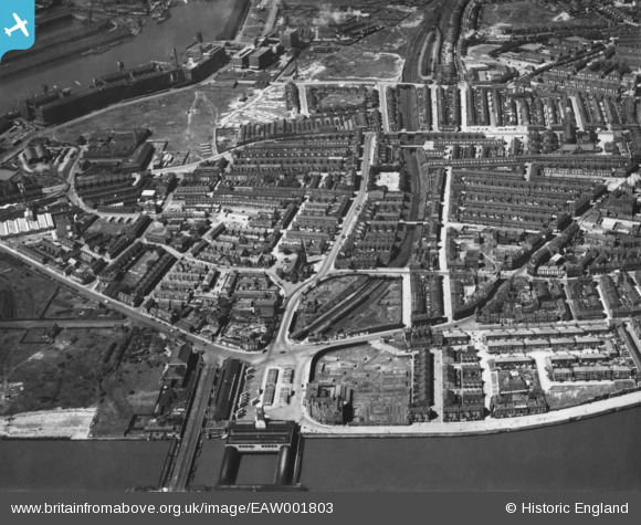
EAW001803 ENGLAND (1946). St Paul's Church and environs, Seacombe, 1946. This image has been produced from a print.
© Copyright OpenStreetMap contributors and licensed by the OpenStreetMap Foundation. 2026. Cartography is licensed as CC BY-SA.
Nearby Images (2)
EAW001803

EAW001802

Details
| Title | [EAW001803] St Paul's Church and environs, Seacombe, 1946. This image has been produced from a print. |
| Reference | EAW001803 |
| Date | 11-July-1946 |
| Link | |
| Place name | SEACOMBE |
| Parish | |
| District | |
| Country | ENGLAND |
| Easting / Northing | 332234, 390763 |
| Longitude / Latitude | -3.0195443814504, 53.409063647384 |
| National Grid Reference | SJ322908 |
Pins

XMAS DAY |
Friday 20th of December 2024 05:02:30 AM | |
|
andy318 |
Wednesday 22nd of February 2023 01:32:07 AM | |
|
andy318 |
Wednesday 22nd of February 2023 01:29:23 AM | |
|
andy318 |
Wednesday 22nd of February 2023 01:26:12 AM | |
|
Bob Fraser |
Monday 30th of November 2015 03:36:34 PM |