
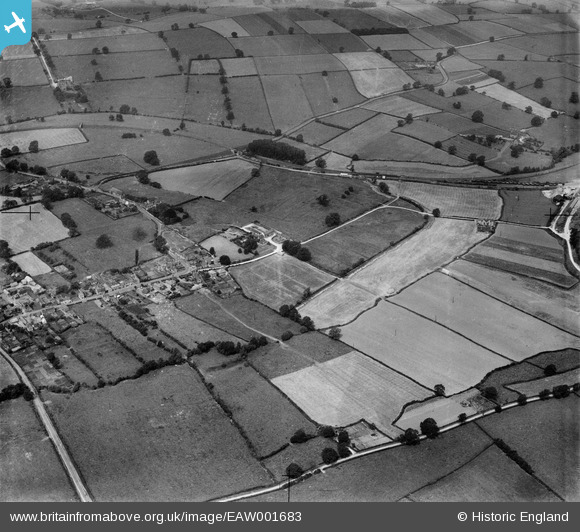
EAW001683 ENGLAND (1946). The village, Worthington, 1946
© Copyright OpenStreetMap contributors and licensed by the OpenStreetMap Foundation. 2024. Cartography is licensed as CC BY-SA.
Nearby Images (3)
EAW001683

EAW001684

EAW001685

Details
| Title | [EAW001683] The village, Worthington, 1946 |
| Reference | EAW001683 |
| Date | 12-July-1946 |
| Link | |
| Place name | WORTHINGTON |
| Parish | WORTHINGTON |
| District | |
| Country | ENGLAND |
| Easting / Northing | 440950, 320777 |
| Longitude / Latitude | -1.3927937779621, 52.782683209302 |
| National Grid Reference | SK410208 |
Pins
Be the first to add a comment to this image!