
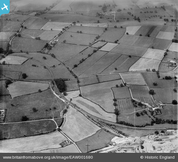
EAW001680 ENGLAND (1946). Worthington Railway Station and environs, Worthington, 1946
© Copyright OpenStreetMap contributors and licensed by the OpenStreetMap Foundation. 2025. Cartography is licensed as CC BY-SA.
Nearby Images (3)
EAW001680

EAW001682

EAW001681

Details
| Title | [EAW001680] Worthington Railway Station and environs, Worthington, 1946 |
| Reference | EAW001680 |
| Date | 12-July-1946 |
| Link | |
| Place name | WORTHINGTON |
| Parish | WORTHINGTON |
| District | |
| Country | ENGLAND |
| Easting / Northing | 440555, 321148 |
| Longitude / Latitude | -1.3986044980871, 52.786048343254 |
| National Grid Reference | SK406211 |
Pins

Peter Kazmierczak |
Monday 27th of October 2014 10:57:46 PM | |
|
Peter Kazmierczak |
Monday 27th of October 2014 10:55:36 PM | |
|
Peter Kazmierczak |
Monday 27th of October 2014 10:54:42 PM | |
|
Peter Kazmierczak |
Thursday 12th of September 2013 10:28:07 PM |